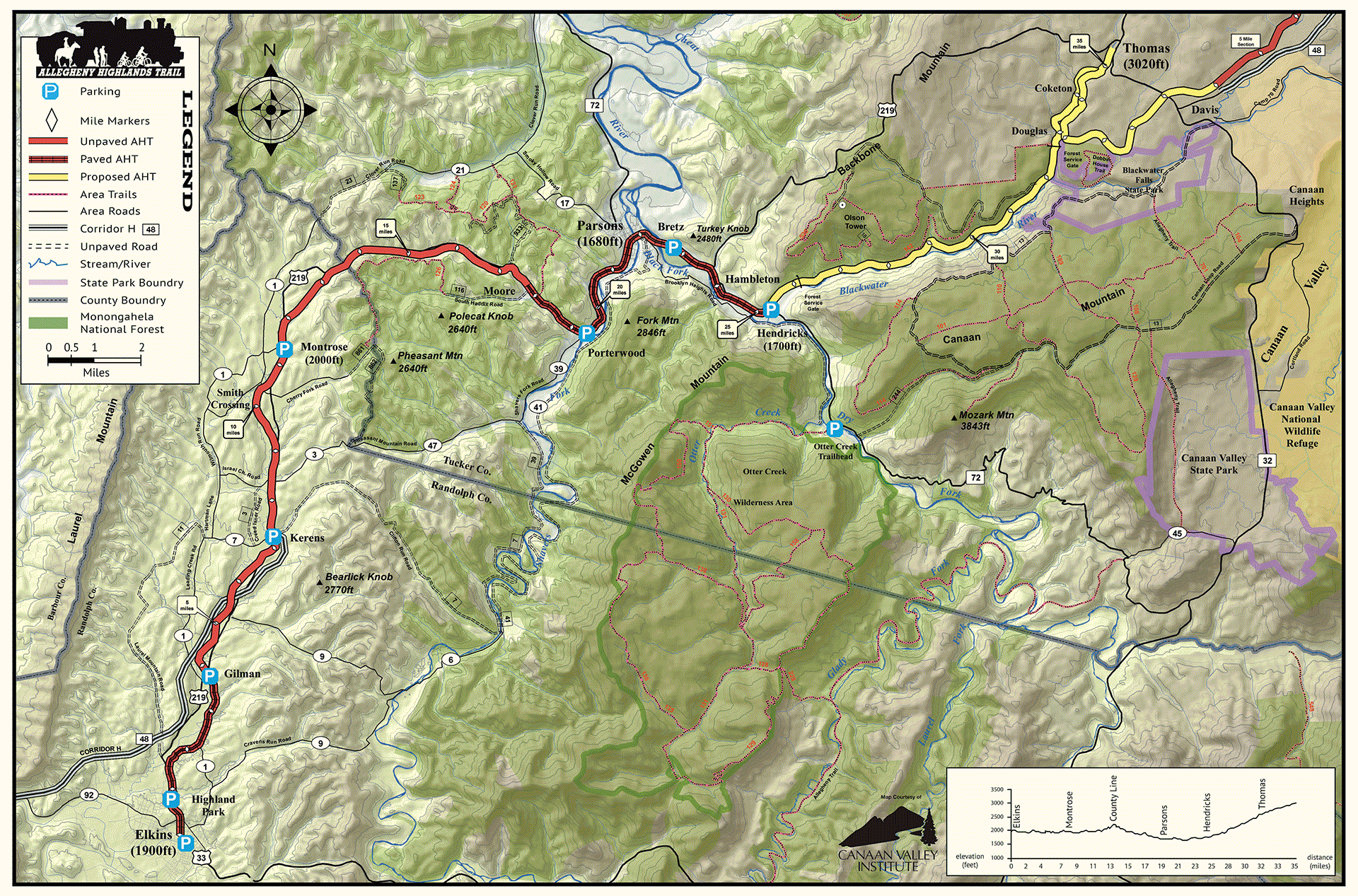
The Allegheny Highlands Trail (AHT) Map provides a detailed overview of the 31-mile rail trail that winds through the scenic landscapes of Randolph and Tucker counties in West Virginia. This map highlights critical points of interest, trailheads, and nearby amenities along the route, making it an essential tool for planning your cycling or hiking adventure. The map also outlines connections to local roads and adjacent trails in the Monongahela National Forest, allowing for extended exploration. Whether biking through small towns, rural farmlands, or rivers and forests, this map ensures you won’t miss any of the stunning vistas along the way.